-
Posts
11308 -
Joined
-
Last visited
-
Days Won
2
Content Type
Profiles
Forums
Store
Downloads
Recruiting - 2020
2019-2020 Football Season
Football
Entertainment
Sports
News and Business
Cloak Room
Transfer Portal
Recruiting
Events
Posts posted by Cajun
-
-
4 hours ago, BlackCat said:
I'll be at two of them. Have several related events all week. Im exhausted.
Hang in there brother.
-
 4
4
-
-
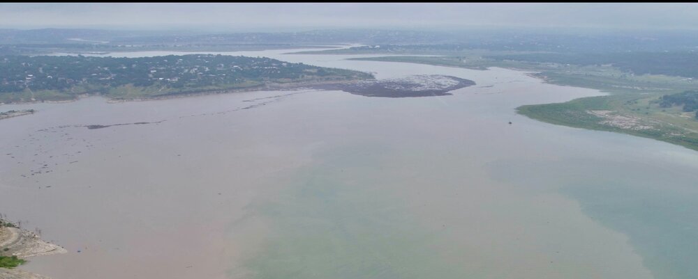
Since they put up the TFR a few days ago there hasn't been any air traffic over the lake till I saw this a few minutes ago--
-
 2
2
-
 2
2
-
-
-
-
Plastics.
-
17 minutes ago, SydneyCarton said:
Nice humble brag. Again. Just know that it worked, I am jealous.
You’re confusing us with Lake Travis. My next door neighbor is a meth lab.
-
 1
1
-
 7
7
-
 1
1
-
-
5 hours ago, UnivTex34 said:
are you willing to fight the FAA?
To me that map represents their un-lubed dildo of consequences.
I think I’ll pass.
-
 2
2
-
-
That is a perfect analogy. Well done.
I may pass that along to him if I see the dude again.
Laughter is definitely at a premium over there.
-
 1
1
-
-
2 minutes ago, SurlyGator said:
As a TESCO baby Monahans native, this hits close to home.
Oh, jokes were made about Monahans. Best beach Pecos has, HOLLA!!!
I was sort of disappointed the guy didn't look a bit more like Billy Bob Thornton though. If I'm being honest.
-
 3
3
-
-
- Popular Post
- Popular Post
39 minutes ago, BlackCat said:Dude thats really cool and I bet that goes farther than you think with those guys.
The commander fella was really sincere about thanking me. The younger dudes (SIL included) were more slap on the back, "man that's good stuff!" thankful but that guy squared me up, stared straight into my eyes, and gave one of those very serious, "Thank you. No, look at me. Thank you" kind of deals. It was unsettling, but not in a bad way if that makes any sense. Of all of them he showed the weight of what they'd been through the most.
The comic relief, though, was one of the guys there complaining about how when this was all over he'd have to go back to Pecos, TX. Having lived out that way for a season of my life I completely understood and co-signed his bitching.
-
 8
8
-
 2
2
-
 3
3
-
-
- Popular Post
- Popular Post
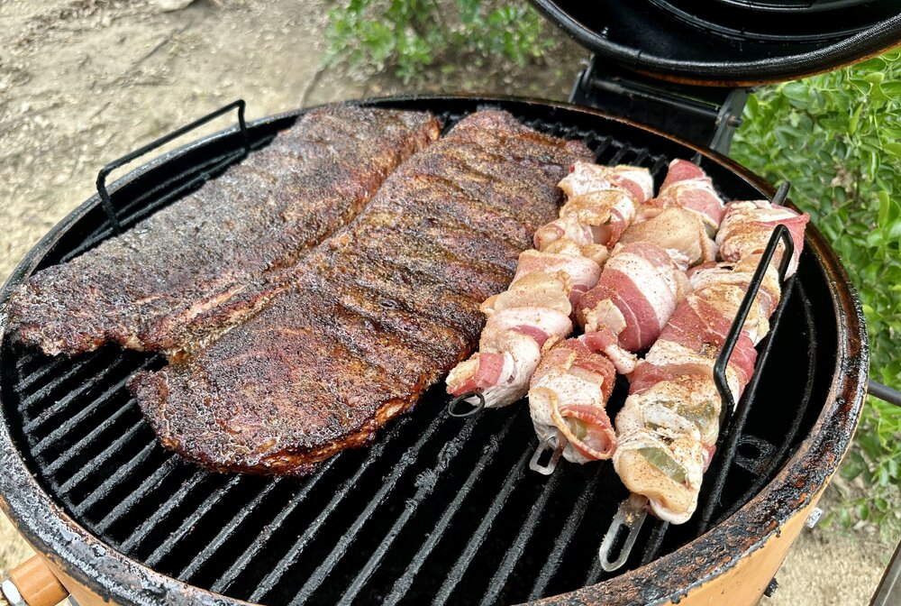
Did the BBQ drop-off in Boerne for the SIL and his team. He said they started in Bergheim today and then went straight to Canyon Lake leapfrogging the teams in between. He said they found a "few" victims and went into a bit of detail on condition, but I'll leave that out here. It's what you think it would be and ID is not easy.
Met his commander, who said the guys in the field were getting fed "But it's the same sandwiches over and over..." then grumbled a bit about "The guys who are staying in Kerrville are getting the good stuff." That is to say the ribs and bacon/jap wrapped chicken skewers were well received. He told me they'd be back searching Canyon Lake tomorrow. That aspect is just surreal. The whole thing is.
Well, so, for the ttwwps purists...
-
 25
25
-
 6
6
-
 5
5
-
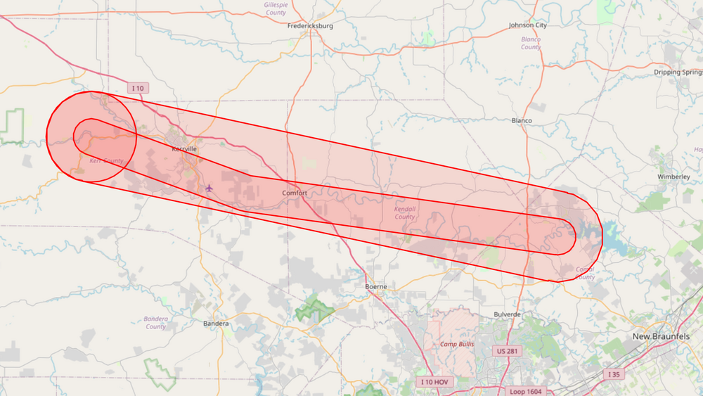
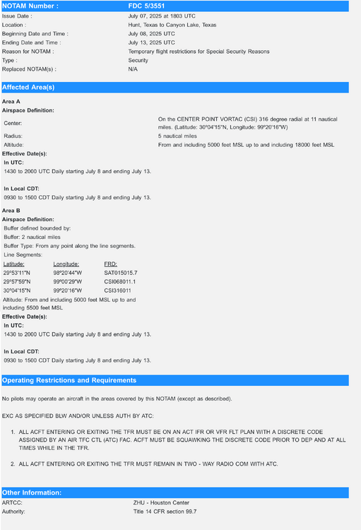
2 hours ago, UnivTex34 said:
In text in case the screenshot is hard to read:
NOTAM Number :FDC 5/3551
Issue Date :July 07, 2025 at 1803 UTC
Location :Hunt, Texas to Canyon Lake, Texas
Beginning Date and Time :July 08, 2025 UTC
Ending Date and Time :July 13, 2025 UTC
Reason for NOTAM :Temporary flight restrictions for Special Security Reasons
Type :Security
Replaced NOTAM(s) :N/A
Affected Area(s)
Area A
Airspace Definition:
Center:On the CENTER POINT VORTAC (CSI) 316 degree radial at 11 nautical miles. (Latitude: 30º04'15"N, Longitude: 99º20'16"W)
Radius:5 nautical miles
Altitude:From and including 5000 feet MSL up to and including 18000 feet MSL
Effective Date(s):
In UTC:
1430 to 2000 UTC Daily starting July 8 and ending July 13.
In Local CDT:
0930 to 1500 CDT Daily starting July 8 and ending July 13.
Area B
Airspace Definition:
Buffer defined bounded by:
Buffer: 2 nautical miles
Buffer Type: From any point along the line segments.
Line Segments:
Latitude:Longitude:FRD:
29º53'11"N98º20'44"WSAT015015.7
29º57'59"N99º00'29"WCSI068011.1
30º04'15"N99º20'16"WCSI316011
Altitude: From and including 5000 feet MSL up to and including 5500 feet MSL
Effective Date(s):
In UTC:
1430 to 2000 UTC Daily starting July 8 and ending July 13.
In Local CDT:
0930 to 1500 CDT Daily starting July 8 and ending July 13.
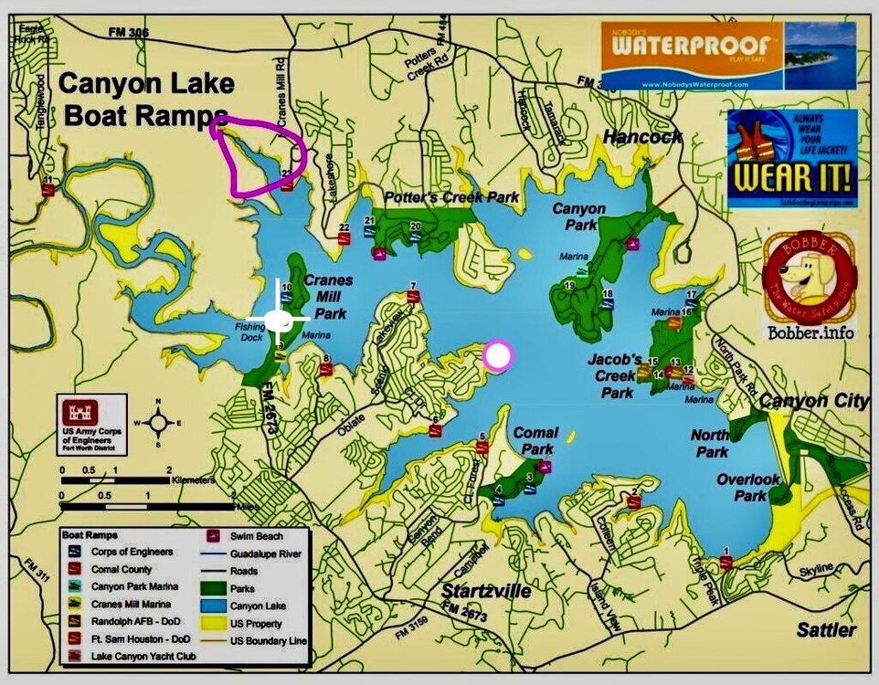
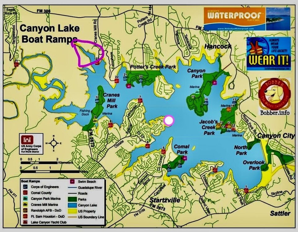
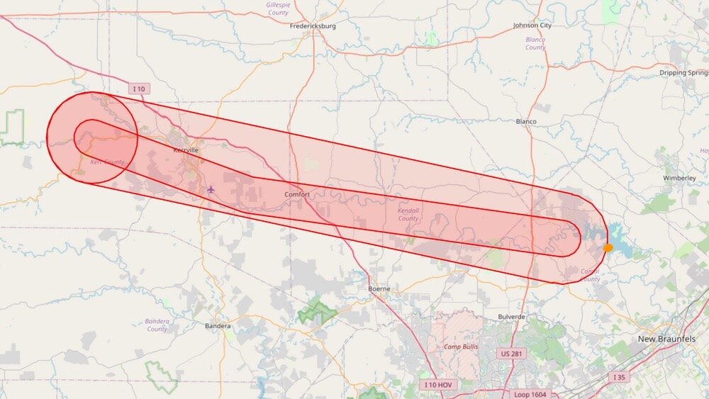
That is something else. I my address is the orange dot. I'm literally the "shake twice" drip --
-
 2
2
-
 1
1
-
-
7 minutes ago, UnivTex34 said:
I haven't flown my drone in probably 2 years, so things may have changed, but used to DJI didn't allow you to fly in a TFR unless you had gotten clearance. My guess is they disabled that in the ongoing fight between the DOJ/FAA and DJI.
I actually had used the FAA Drone app to bypass a TFR (getting permission to fly under 100 feet AGL). So I remember the old process pretty well. Been too busy the last few years to get the bird in the sky.
I usually rely on that automatic "grounding" feature of my Mavic along with word from my neighbor who is a retired SWA pilot and professional drone operator giving me the 411 on what's GO/NO GO.
looks like I need to rethink those protocols. I DO NOT want a sit down with the FAA. Ever.
-
-
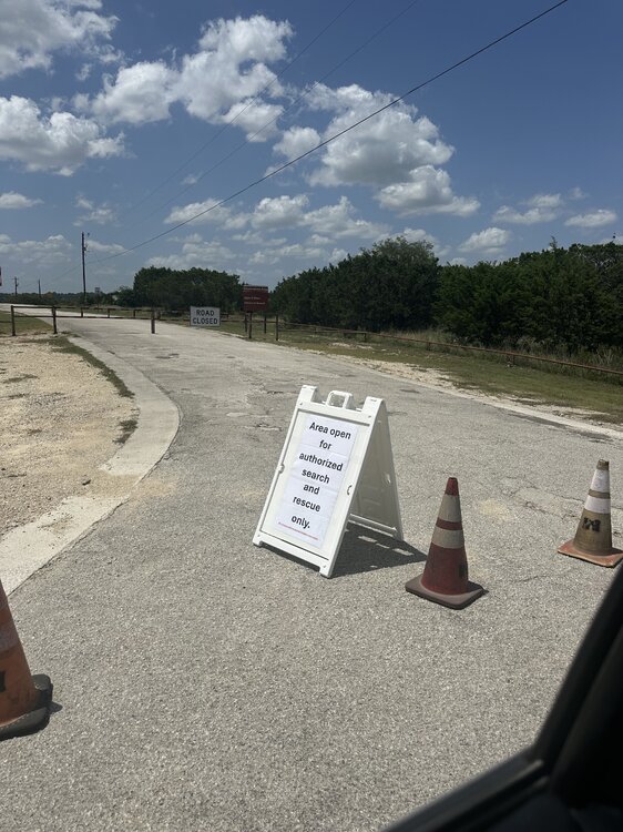
I've been flying the drone, so I hope I'm not out of compliance. The deer was already being collected by animal control at ramp 7. That's how I noticed it on my bike ride.
-
 1
1
-
 1
1
-
-
- Popular Post
- Popular Post
SIL said his DPS recovery team is now staging from the park in Bergheim (just outside of Boerne) for their work today. That's maybe 20 minutes from Canyon Lake. They are working their way here fast.
I saw dead deer floating in the lake yesterday. I think some victims are going to be found a few hundred yards from my front door.
FML
On a happier note he said they attacked that brisket like it had bullied them in grade school. Firing up that mf'er again and taking some swine tonight. Guessing I'll learn some things. Will report back what I can.
-
 7
7
-
 5
5
-
 1
1
-
-
Yeah, and still rising too.
-
-
5 minutes ago, Cajun said:
FML. Took a bike ride down to boat ramp 7 just to see what's what. This was going on. Up & down the shorelines slow & methodically ---
Reposting as .mp4 for those who can't bring it up--
-
 1
1
-
-
FML. Took a bike ride down to boat ramp 7 just to see what's what. This was going on. Up & down the shorelines slow & methodically ---
-
 6
6
-
 2
2
-
-
5 hours ago, Homesickhorn said:
That was Saturday?
Fuck me dead.Saturday morning.
-
 1
1
-
-



2025 Thread of the Rains
in Daily Texan
Posted · Edited by Cajun
^^That combined is more than Canyon Lake at capacity. Wow.
I'm expecting CL to be close to 70% full by Wednesday. Another big slug of H20 heading here from Kerrville/Comfort right now.