-
Posts
8016 -
Joined
-
Last visited
Content Type
Profiles
Forums
Store
Downloads
Recruiting - 2020
2019-2020 Football Season
Football
Entertainment
Sports
News and Business
Cloak Room
Transfer Portal
Recruiting
Events
Posts posted by Rip76
-
-
Well well
-
-
Such an addictive show.
-
Fantastic play
-
-
-
Pearl Jam Drummer Matt Cameron Steps Down From Band
https://www.yahoo.com/entertainment/articles/pearl-jam-drummer-matt-cameron-144535897.html
-
TX Flood Update (Mon AM)
- Heavy rainfall and flash flooding remain possible today across central Texas and the Hill Country
- Persons including response personnel must remain aware of rapidly changing weather conditions and be prepared to take quick action
Forecast:
Mid level trough axis that has plagued central Texas since late last week continues over the region this morning situated with a tropical air mass with extremely high moisture levels. This pattern continues to support periodic episodes of heavy rainfall over central Texas and the Hill Country, but storm motions have been faster in the last day or so and organization of cells less compared to both Thursday and Friday nights when anchored and slow moving cells produce prodigious rainfall totals in short order.
While guidance continues to suggest portions of this area could see additional heavy rainfall and extreme totals of up to 10 inches in a short period of time the exact location of any such occurrence is in question and low confidence. However, such totals would result in rapid onset flash flooding given background conditions over the area.
Trough axis should finally begin to break down into Tuesday with lowering chances for heavy rainfall and flash flooding over this part of the state.
Rivers:
All rivers have passed recent flood flows downstream into receiving lakes that have and continue to hold inflows due to extremely low pool levels in this area from the ongoing longer term drought. There are no significant ongoing impacts along any of the rivers, although the following are running above base flow this morning:
- Guadalupe River
- San Gabriel River
- Upper San Saba River (Near Mason TX)
- Leon River
- Sandy Creek at Kingsland TX
None of these rivers or creeks are currently at levels nor forecasted to rise to levels that would cause any significant impacts.
Guadalupe River Flood Disaster:
A USGS team was able to reach the Hunt, TX river gage over the weekend and was able to establish from the gage data and high water mark an elevation of 37.52 ft. While data evaluation is still ongoing…the preliminary information suggests this is a flood of record at Hunt, TX surpassing the flood of 1932 of 36.60 ft. The following table is a list of the top 5 all-time flood elevations for the Hunt, TX gage:
- 37.52 ft (July 4, 2025)
- 36.60 ft (July 2, 1932)
- 28.40 ft (July 17, 1987)
- 23.50 ft (August 2, 1978)
- 22.80 ft (October 19, 1985)
It is interesting to note that the top 3 all-time floods at this site all occurred in the month of July.
At Kerrville, TX a peak gage height of 34.29 ft was recorded making this event the 3rd highest on record for this location behind the July 1932 and July 1987 floods. The following table is a list of the top 5 all-time flood elevations for the Kerrville, TX gage:
- 39.0 ft (July 2, 1932)
- 37.72 ft (July 17, 1987)
- 34.29 ft (July 4, 2025)
- 17.93 ft (November 11, 2000)
- 17.73 ft (October 28, 1996)
The Kerrville gage rose from 1.82 ft at 5:15 am to a peak of 34.29 ft at 6:45 am or 32.47 ft in 1.5 hrs.
With the number of fatalities surpassing 80 on Sunday, this TX flood event appears to be the deadliest non-tropical flood event in American history since the 1979 Big Thompson Canyon Flood in Colorado which claimed 144 lives.
Jeff Lindner
Director Hydrologic Operations Division/Meteorologist
Harris County Flood Control District
-
 3
3
-
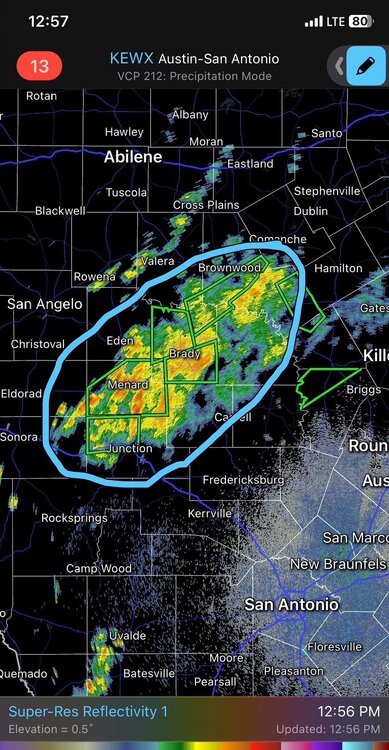
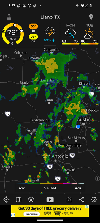
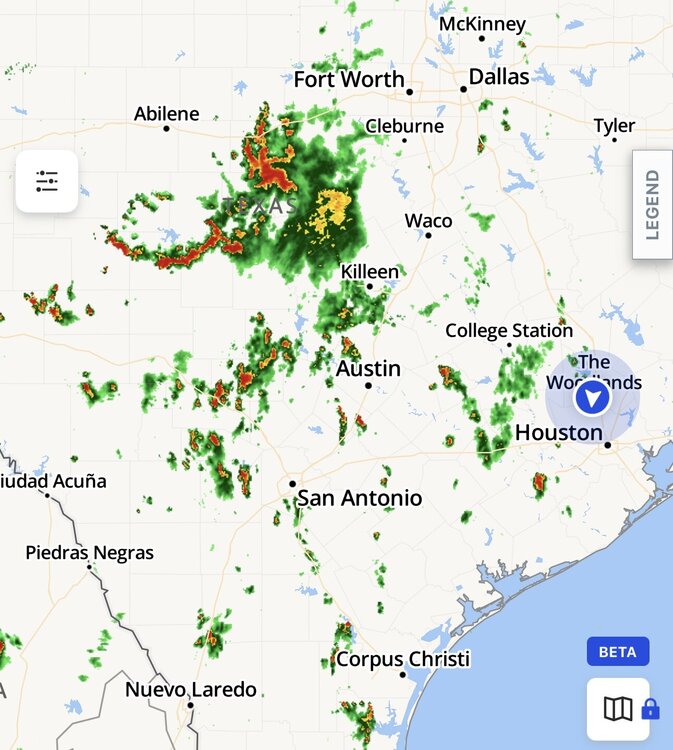
Sorry that was radar from 7:30
-
-
-
I consider myself a believer, and I’m still in search of where I want to land so to speak.
I’ve always believed that God lets things happen. It’s just how I’ve always thought. I believe mainly that prayer is for you and me to feel closer to God.
I don’t know if I believe that prayer has ever prevented or helped an outcome.
-
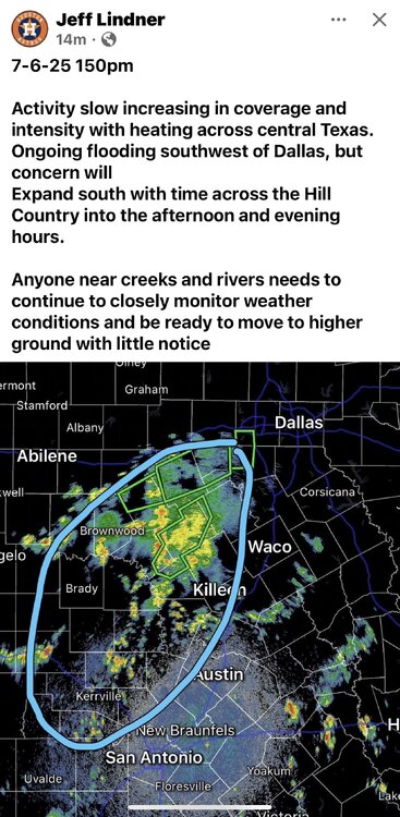
TX Flood Update (Sun PM)
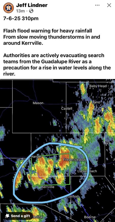
- Heavy rainfall and flash flooding has redeveloped over portions of north Texas and recently over the Guadelupe River
- Additional heavy rainfall and flash flooding is possible tonight over the TX Hill Country
- Persons across central TX and the Hill Country need to remain informed on weather conditions that can change rapidly.
Guadelupe River:
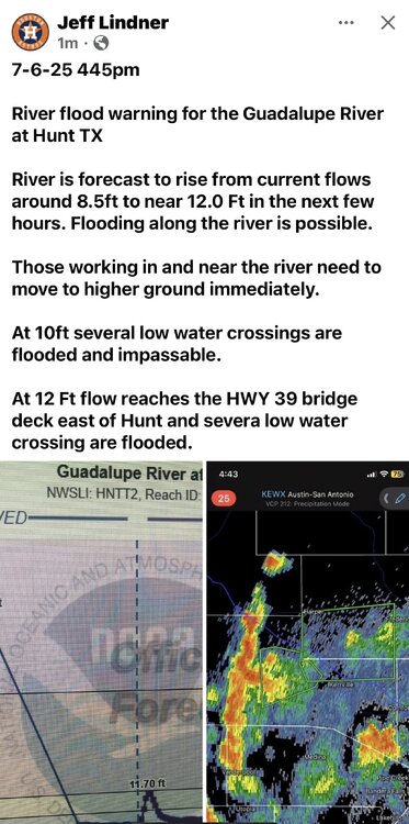
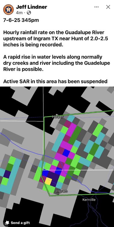
Heavy rainfall has occurred in the last hour upstream of Kerrville in the Ingram and Hunt areas. Rainfall amounts of 1-3 inches have been recorded and this is expected to result in a rise in the Guadelupe River to above flood stage in the next hour or so with peak near 12 ft around Hunt, TX. At these level slow water crossings are flooded and impassable with fast flowing water and flow reaches the bottom of the HWY 39 bridge crossing. Areas upstream of Hunt may become cut-off on both the south and north Forks of the Guadelupe River.
Ongoing search and rescue operations have been suspended in this area due to the threat of flash flooding and any persons near the river need to seek higher ground.
Note: TFR is in place for Kerr County due to private drone interference with rescue operations along with other SAR activities.
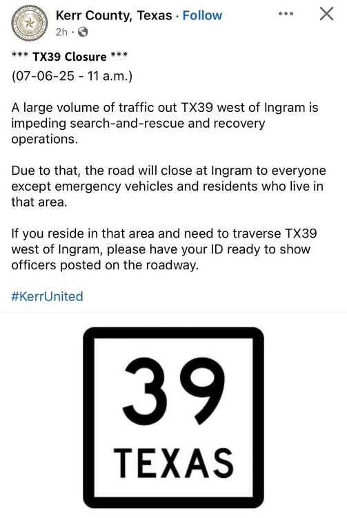
Note: Traffic congestion in this region is extremely heavy due to search and rescue efforts and influx of various support teams. Those not needing to be in this area should refrain from travel to the impacted areas.
NC TX:
Heavy rainfall focused this morning and early afternoon northwest of Waco and southwest of Fort Worth with several areas of ongoing flash flooding. Rainfall in this area has weakened and is shifting southward into a more unstable air mass over the I-35 corridor into the TX Hill Country.
Forecast:
Guidance generally shows activity weakening this eveninginto the overnight hours only to redevelop over the I-35 corridor and Hill Country on Monday.
As we have been dealing with the last several days…isolated instances of extreme rainfall will be possible with very high hourly rainfall rates which will lead to rapid flash flooding of normally dry creeks and rivers. The locations and amounts of any significant rainfall amounts remain in flux, but the general air mass remains capable of some significant totals. Persons must remain aware of changing weather conditions in this area into Monday.
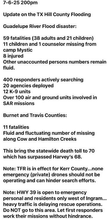
The current statewide death toll has risen to 70 which has surpassed Harvey’s 68. While data is still be looked at and collect and numbers are fluid, this is one of the most fatalities from a flash flood event in the state of Texas in modern times.
Kerr County: 59
Travis County: 5
Burnet County: 3
Williamson County: 2
Tom Green County: 1
These numbers were as of 245pm today.
Jeff Lindner
Director Hydrologic Operations Division/Meteorologist
Harris County Flood Control District
-
 1
1
-
-
-
Side note, CNN has been running non-stop coverage all day.
Looks like the only channel that is.
-
 2
2
-
 1
1
-
-
-
-
-
-
6 minutes ago, BurntOrange&White said:
Seeing some reports that 2 girls were found near centerpoint about 30 ft up in a tree alive.
-
 2
2
-
 2
2
-
-
-
-


July 4th Hill Country Flooding Tragedy
in Daily Texan
Posted
CNN has been all over this.